I would just like to add that I experience almost all the problems that @GeoLemmi described, and in addition, going to Settings is now very long (several dozen seconds until you can scroll down the settings screen).
I really miss quickly switching themes and their settings right on the map view.
For example, in the Elements theme, forests are visible only at certain magnifications, and in others, they disappear. Buildings cannot be seen at all. If you need, I can make a movie, but you can probably check it yourself. And I confirm that in other applications the themes work as expected.
Of course "Storage. Cached Data" not "geocache". I also checked 11.2.4 which updated overnight.
By the way, I have another request. In dark mode, the geocache coordinates are shown in black on a gray background. I think the coordinates should more contrast color – maybe green like as icons?
In the last few updates, I noticed a problem with the automatic translation of some phrases in the application interface to the system language, despite disabling this option in the settings. This is quite annoying because some phrases are not correctly translated into the phrases used in Polish geocaching vocabulary.
Hello, I have a problem with certain waypoints. After clicking the brown waypoint icon on the map - I get a white (empty) popup. Sometimes this is fixed for some waypoints and never works for others.
Could you please check it, e.g. for the cache: GC892T2
It's great now. Themes also work. The first time they did not work properly (part of the map was from the theme, and some was not), but after removing the cache the map had the correct theme and everything looks beautiful.
Unfortunately, I see only a slight improvement. In version 10.X, as far as I remember, the map was loading very quickly (this was not instant, but acceptable). In version 11.0.4-11.0.5, the offline map was loading for about 24-26 seconds (nightmare!). In version 11.0.6, the offline map loads in about 12-13 seconds.
Yes, Waypoint from the description can only be copied manually (select text and copy). Then you can add it to the offline list and it will be displayed on the map. But how else can this be resolved? Each time the application is to check all descriptions, are there no coordinates saved in them? Maybe some "Search waypoints in description" button? On the other hand, it is probably a relatively rare situation when the waypoint is not added "officially", but only in the description.
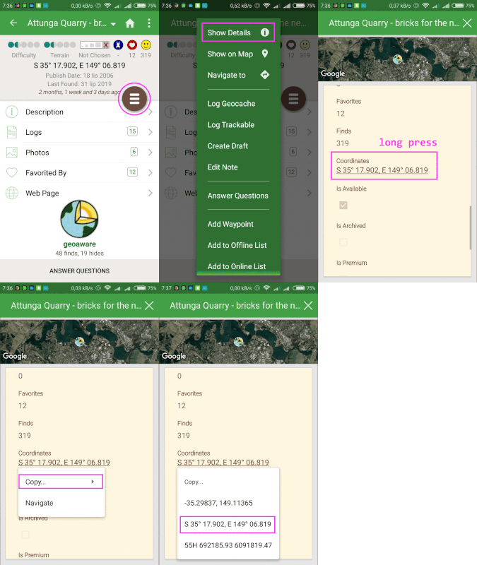
GIF: a) taking five screenshots b) editing files (pink frames and texts) c) ezgif.com/maker + resize d) uploading files to postimages.org e) "insert an image" to post
 Go Caching with Geooh